
Flowing water is one of the freest forms of energy in the world, and especially in the wet landscapes of the St. Croix River and its tributaries. Humans have harnessed water in this area for at least a couple centuries — for transporting timber to mills, generating electricity, providing habitat for wildlife like waterfowl, and maintaining lakes for fishing, swimming, and living on.
Dams have also caused a lot of problems. They block fish movement, eliminating species that rely on movement and migration through the system, or that depend on spawning habitat disturbed by dams. The structures can and do fail, sending dangerous floods downstream.
Protecting some rivers as un-dammed and “free-flowing” was a key goal of the 1968 Wild and Scenic Rivers Act, which protected the upper St. Croix River.

The upper St. Croix was described as the 100 miles above the twin towns of Taylors and St. Croix Falls, Minnesota and Wisconsin, respectively. It was here that Northern States Power in 1907 built the large hydroelectric dam that still stands today. But above this 60-foot dam, there was to be be no more obstructions to this wild river.
One motivating reason for the legislation was the proposal to dam extensive lengths of the upper river for a series of hydropower dams that would change the rushing stream to a series of long lakes. The river was left to its own devices.
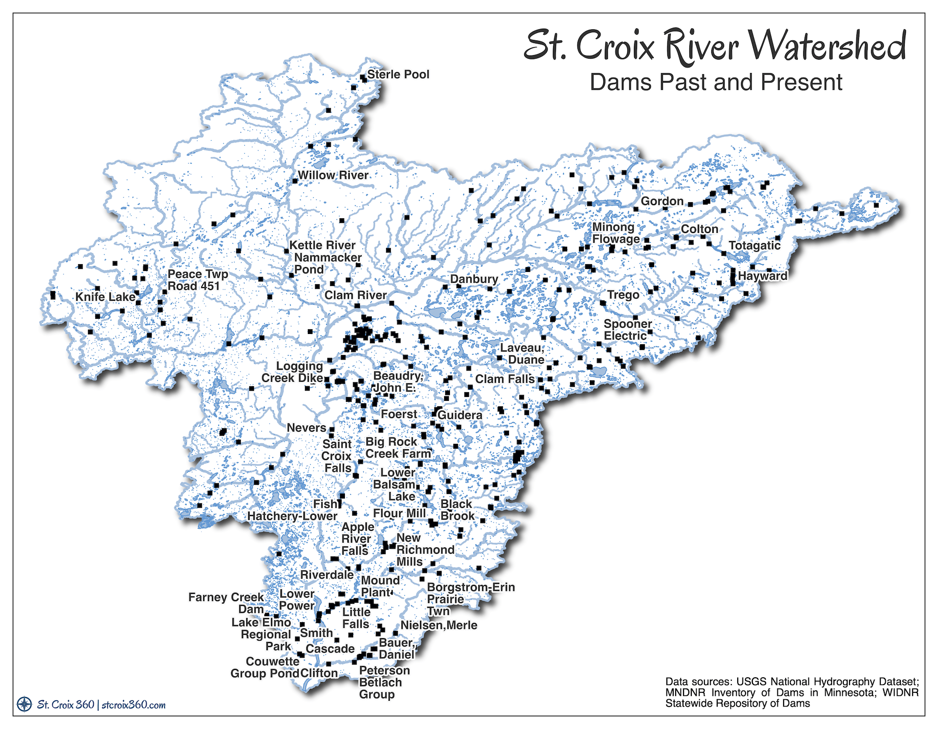
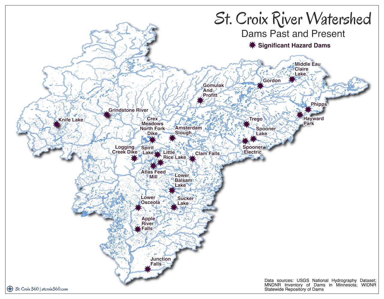
St. Croix River tributary dams
But, while the St. Croix itself is probably safe from any new dams, the river is only as healthy as its whole watershed. The thousands of miles of streams that flow toward the St. Croix also have numerous dams on them.
Significant dams are owned by Xcel Energy on the Namekagon and Apple. The two states also own and manage many small dams that maintain water levels in lakes and wetlands. And many more dams big and small are scattered among private owners.
Both Minnesota and Wisconsin keep an inventory of dams in the respective states. It is likely incomplete, but captures most of the major structures and many minor dams.
Based on these databases, there are 68 dams in the Minnesota portion of the St. Croix watershed, and 363 dams on the Wisconsin side (for a total of 431). This big difference in documented dams is one reason to carefully consider the quality of the data. It could be accurate, and the hydrology, settlement patterns, and more on both sides of the river may affect the abundance of dams. It could be that Wisconsin has identified more of the smaller dams that are easy to miss.
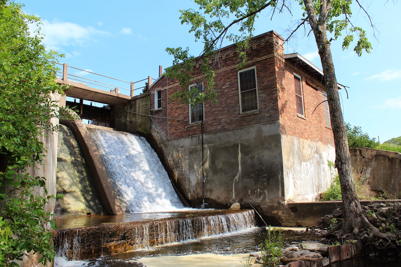
Today, several dams in various conditions still stand on the upper river. The only functioning dams on the National Scenic Riverway are on the Namekagon River at Trego and Hayward, both owned by Xcel Energy. The National Park Service-managed riverway on the St. Croix begins below the Gordon Dam, another significant structure. From there to St. Croix Falls, there are the abandoned and only slightly-functioning Coppermine and Nevers Dams. Other stone wing dams and similar structures built for logging and navigation are also still evident.
Dam dangers
Dams present multiple safety hazards. They are dangerous for people trying to enjoy a river, and can wash out suddenly in floods, threatening downstream residents and structures. State inspectors rate dams for hazard level, identifying issues where repairs or removal are needed, or where failure could have disastrous effects.
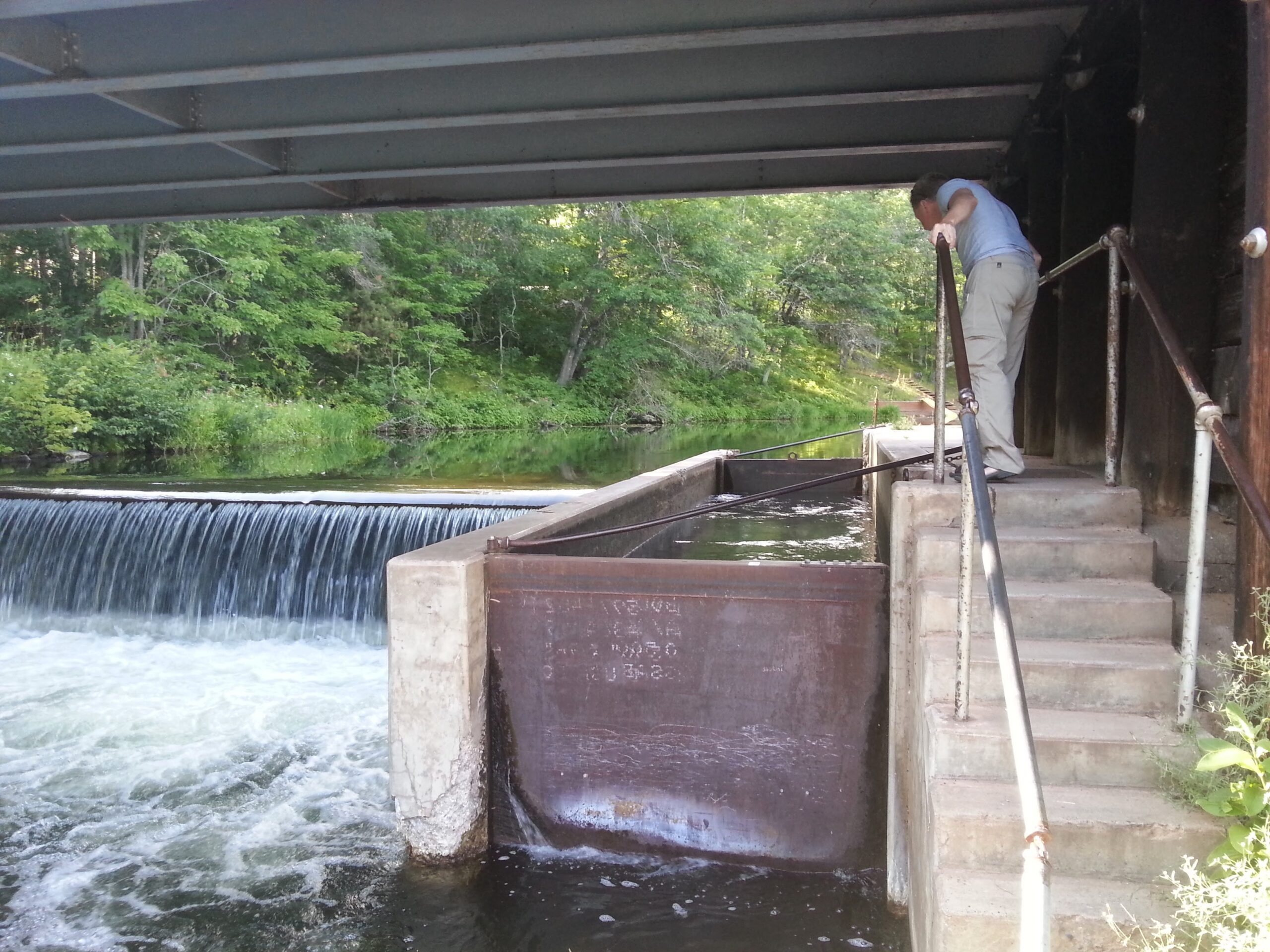
In April 2005, thirty-year-old whitewater kayaker Jason Ray tried to paddle over a dam and drowned on the Snake River near Pine City, at the outlet of Cross Lake. This type of low-head dam is sometimes called a “drowning machine” for its deceptive dangers. He was caught by the dam’s powerful hydraulic forces below, and died before his companions, who portaged around the dam, could pull him out. It was one of many deaths caused by dams documented across the country in a database provided by Brigham Young University and American Rivers.

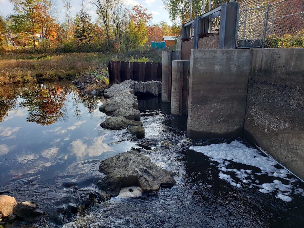
In response to the incident and others at the dam, the DNR invested about $250,000 in upgrading its safety. The agency filled the channel below with rock, creating a riffle that improves fish habitat as well as removing the dam hazards.
In 2018, the Radigan Dam on the Upper Tamarack River, in the unincorporated town of Dairyland, Wisconsin, blew out after torrential rains. It sent a wall of water downstream to the St. Croix that threatened people and property below, flooding cabins, and endangering everyone.
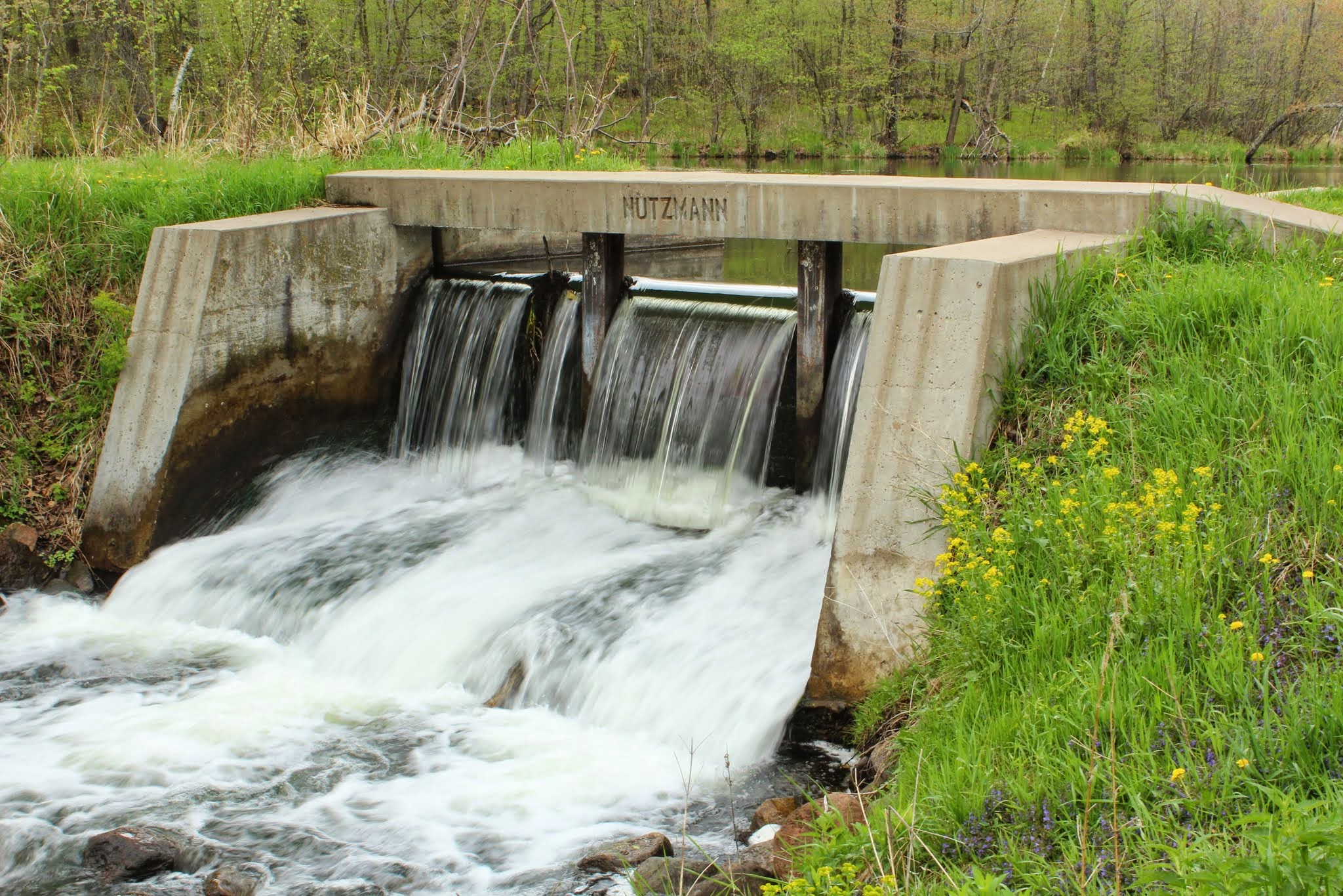
And many of the most harmful and dangerous dams also provide the least benefits, no longer generating power and thus neglected, or holding water back to float lumber that hasn’t come in more than a century.
Removal ramps up
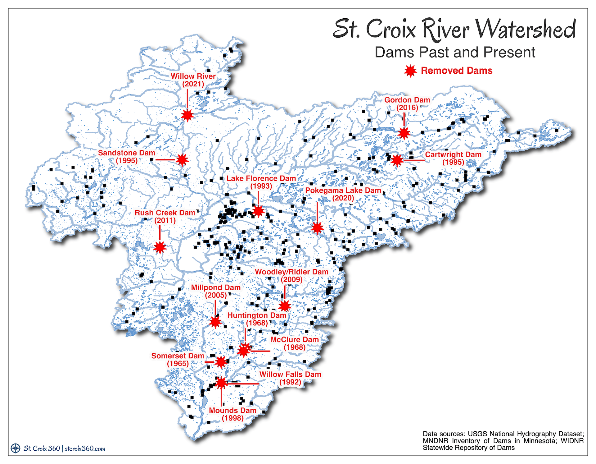
Removing dams has become more popular every year for decades. Between 2000 and 2004, the USGS documented 156 dam removals. In the most recent period for which data is available, 2015 to 2019, the agency counted 437 removals.
National advocacy group American Rivers reports that 57 dams were removed from streams across the country last year. Wisconsin removed the fourth most with four dams eliminated. In a database of dam removals in the United States between 1912 and 2021, American Rivers reports 14 dams removed in the St. Croix River watershed.

Last year, the Minnesota DNR completed removal and reconstruction of a dam on the Willow River, near its confluence with the Kettle River. The water held back by the dam created a lake popular with property-owners and campers at a state forest campground. Like it did at the dangerous Snake River dam, the agency created a rocky slope for the water to tumble down, rather than a single vertical drop.
Additional efforts are underway in the St. Croix River system. The Minnesota Department of Natural Resources is currently preparing an environmental impact statement to remove the Grindstone Dam, rated a “significant” hazard, near Hinckley. In Wisconsin. The city of River Falls is responding to a community push to remove dams on the Kinnickinnic River within the next several years, to bring back the falls that gave the city its name, and restore habitat for the river’s renowned trout.
Hundreds more dams are scattered across the area. They were put up in a matter of 50 years or so, but it will likely be centuries before most rivers run free again.


 Creative Commons Attribution-ShareAlike
Comments
4 responses to “Maps and more: Dams of the St. Croix River system”
The dam between Taylors Falls and St. Croix Falls was already complete and its power house sending electricity to Minneapolis in December 1906.
Nice article, Greg. Reservoirs also provide flood mitigation benefits, which may be very important if climate change brings larger rainfall totals and more intense events. We need more research to identify alternative ways to achieve flood mitigation without the disruption to the river continuum caused by the abrupt vertical drop of dams.
As far as I can tell, the dam holding back Pokegama Lake in Minong, WI is still there. It was “rebuilt” in 2020, not removed as the attached map indicates.
The pictured lock and dam between Middle and Lower Eau Claire lakes was repaired/rebuilt in 2015. Planning is in process to replace the bridge (2022)